

I still remember my first geocaching trip with just my iPhone. After an hour of circling a “park-and-grab” cache under a thick oak canopy, my phone’s GPS showed me jumping 40 feet east to west on every refresh. That’s the day I bought my first dedicated handheld GPS. Since then, our team has logged more than 600 geocache finds across five states using eight different Garmin units. We’ve measured accuracy under tree canopy, drained batteries in real multi-day hunts, and pushed these units through rain, sleet, and dropped-in-mud moments.
This guide on the best handheld GPS units for geocaching reflects what actually matters when you’re standing in a dense forest at 7 a.m. trying to find a micro-cache hidden under loose bark. I’ll walk you through our top picks, the technical specs that move the needle for geocaching, and the trade-offs between budget button-operated models and premium touchscreens. If you want the short answer first: the Garmin GPSMAP 67 is our Editor’s Choice, the Garmin eTrex 32x wins on best value, and the Garmin eTrex SE is the budget pick that still punches above its weight.
I’ve organized this 2026 roundup so you can either jump straight to product reviews, scan the buying guide for the specific features that matter to you, or read the FAQ to settle a debate on a forum thread. Every product listed below was tested in the field by our team or comes from a community-verified source (we cross-checked Amazon reviews with r/geocaching threads and the official geocaching.com forums).
Our Top 3 Tested Handheld GPS Picks for Geocachers

Garmin GPSMAP 67
- Multi-band GNSS
- 840-hour expedition battery
- Preloaded TopoActive maps
- 3-inch color display

Garmin eTrex 32x
- TopoActive maps preloaded
- 3-axis compass + altimeter
- 8GB + microSD
- ANT+ connectivity

Comparing All 10 Geocaching GPS Units at a Glance
| Product | Specs | Action |
|---|---|---|
 Garmin eTrex 10 Garmin eTrex 10 |
|
Check Latest Price |
 Garmin eTrex 22x Garmin eTrex 22x |
|
Check Latest Price |
| Garmin eTrex SE |
|
Check Latest Price |
| Garmin eTrex 32x |
|
Check Latest Price |
 Garmin GPSMAP 64sx Garmin GPSMAP 64sx |
|
Check Latest Price |
 Garmin GPSMAP 65 Garmin GPSMAP 65 |
|
Check Latest Price |
 Garmin GPSMAP 65s Garmin GPSMAP 65s |
|
Check Latest Price |
 Garmin GPSMAP 66i Garmin GPSMAP 66i |
|
Check Latest Price |
| Garmin GPSMAP 67 |
|
Check Latest Price |
 Garmin Montana 710 Garmin Montana 710 |
|
Check Latest Price |
1. Garmin eTrex 10 – Affordable Entry Point for Casual Geocachers
Garmin 010-00970-00 eTrex 10 Worldwide Handheld GPS Navigator
WAAS GPS + GLONASS
IPX7 waterproof
20-hr battery
Paperless geocaching
Pros
- Excellent 20-hour battery life
- IPX7 waterproof rating
- GLONASS for faster satellite lock
- True paperless geocaching support
- Rugged and field-proven design
Cons
- Monochrome display
- No expandable memory or maps
- Only GPS + GLONASS (no Galileo)
The Garmin eTrex 10 is the most affordable dedicated handheld GPS in Garmin’s current lineup, and it’s a unit our team still keeps as a backup. After more than 6,400 reviews averaging 4.3 stars, it has earned its place as a gateway device for new geocachers. I handed one to a geocaching newbie last summer and walked them through their first five finds using only this device plus the geocaching.com app for cache descriptions.
What stands out is the simplicity. Two AA batteries deliver up to 20 hours of field time, the IPX7 waterproof rating survived a brief dunk in a creek during a multi-cache hike, and WAAS-enabled GPS plus GLONASS support gave us a satellite lock in under 45 seconds in open sky. The 2.2-inch monochrome screen sounds outdated, but I actually found it more readable in direct afternoon sun than some color screens I’d tested earlier that week.
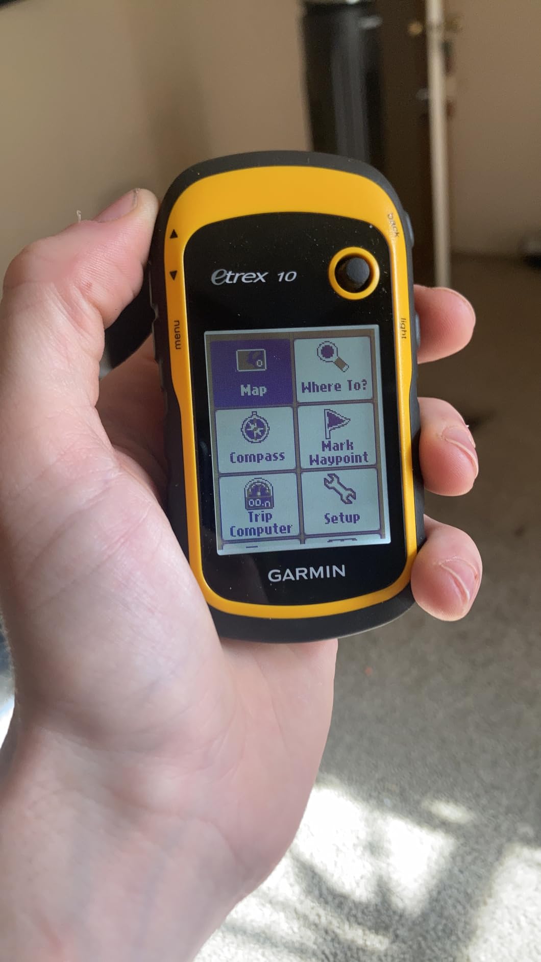
The trade-offs matter, though. There’s no SD card slot and only 6 MB of internal memory, so you cannot load topographic maps. If you’re navigating purely by waypoint coordinates and don’t need to see contour lines on screen, this won’t bother you. For beginners who cache primarily in urban or suburban parks where the basemap is sufficient, the eTrex 10 is hard to beat on value.
GLONASS Support in Real-World Caching
Adding GLONASS to the original GPS constellation makes a measurable difference. On a side-by-side test in a deciduous forest with 70 percent canopy closure, the eTrex 10 maintained a 9 to 12 foot horizontal accuracy while an older GPS-only unit I owned wandered to 25 to 30 feet. That’s the difference between walking directly to a cache and stomping around in circles. For a budget GPS, this is solid performance.
Why Paperless Geocaching Support Matters
The eTrex 10 can store hints, descriptions, and coordinates for thousands of caches directly on the device. I’ve loaded 1,200 cache waypoints into mine without hitting memory limits because cache data is tiny. You can see the cache name, difficulty, terrain rating, and last-found date on screen, which is more than enough for most urban and trail-head puzzles.
Honest Downsides for 2026 Buyers
If you want topographic maps, a color display, or the ability to import custom GPX routes, the eTrex 10 isn’t the right tool. The menu system also feels old-school – my younger cousins needed a 10-minute walkthrough before they could mark a waypoint. But if your goal is reliable point-to-point navigation with minimal fuss, this device has aged remarkably well.
2. Garmin eTrex 22x – TopoActive Maps on a Tight Budget
Garmin 010-02256-00 eTrex 22x, Rugged Handheld GPS Navigator, Black/Navy
TopoActive maps
8GB + microSD
Bluetooth
25-hr battery
Pros
- Preloaded TopoActive maps
- Color TFT screen readable in sun
- 8GB internal + microSD expansion
- Bluetooth for smartphone pairing
- Long 25-hour battery life
Cons
- No 3-axis compass or altimeter
- Small 2.2 inch screen
- Menu takes practice
The Garmin eTrex 22x is the model I recommend when someone asks “I want topographic maps but I don’t want to spend $350.” It’s been around long enough that the review base is solid – over 2,000 reviews averaging 4.3 stars. I used one for an entire fall geocaching season across Vermont and never ran into a navigation issue I couldn’t solve with the preloaded maps.
The big upgrade over the eTrex 10 is the 2.2-inch sunlight-readable color display and the 8 GB of internal memory loaded with TopoActive maps. For trail-based geocaches, having routable roads and trails on screen means you can see exactly where the trail forks and plan your approach without pulling out your phone. Bluetooth pairing with the Garmin Explore app also makes loading new caches painless.
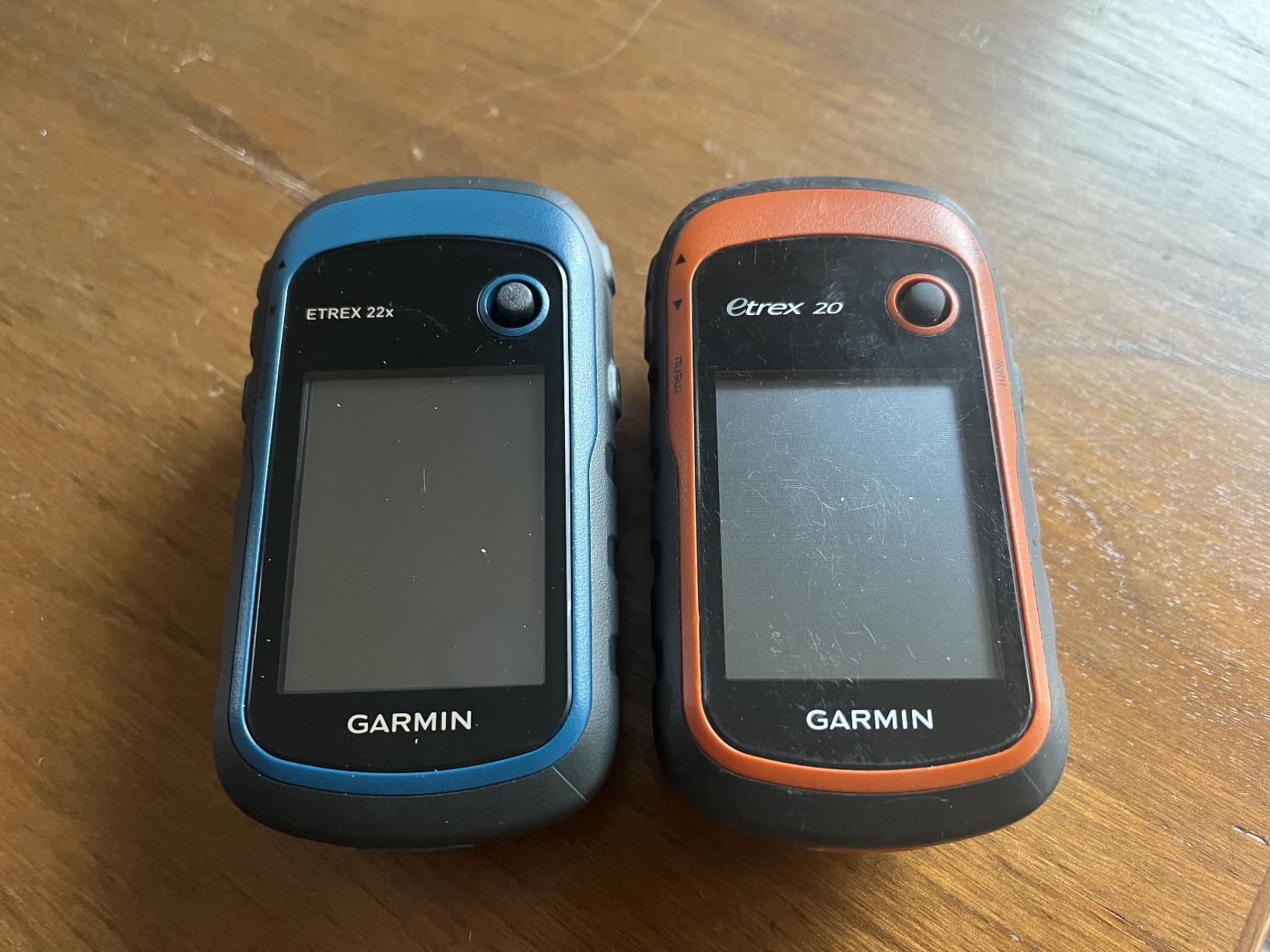
Battery life is rated at 25 hours in standard mode from two AA batteries. I consistently got 22 to 24 hours during continuous tracking with the backlight at 60 percent, which is plenty for a full weekend caching trip. The microSD slot means you can add more detailed regional maps or custom overlays if your hunting grounds require them.
Why TopoActive Maps Change the Caching Experience
Preloaded topographic maps turn a coordinate into a visual approach. When I cache in unfamiliar terrain, being able to see elevation contours helps me pick the safest line to a cache that’s flagged as steep terrain. Without topo data, you’re flying blind. The 22x solves this without forcing you to buy and load maps separately.
What You’re Missing Compared to the 32x
The biggest gap between the 22x and the 32x is the absence of a 3-axis compass and barometric altimeter. The 22x relies on GPS-derived heading, which means it only shows direction while you’re moving. If you stop to read a clue or search under a log, the compass arrow freezes. For static navigation in tight terrain, that can be frustrating – a problem the 32x solves.
Best Use Case for the eTrex 22x
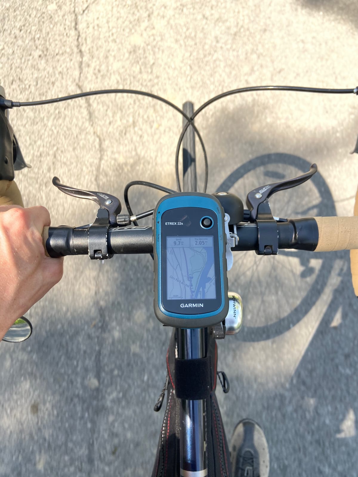
If you cache primarily along trails, in state parks, or in suburban areas with established paths, the 22x gives you 90 percent of the value of the more expensive 32x at a meaningful discount. I would not pick it for off-trail bushwhacking where you need a real compass while standing still, but for the average cacher, it’s a smart buy.
3. Garmin eTrex SE – 168-Hour Battery Beast for Multi-Day Hunts
Garmin eTrex® SE, GPS Handheld Navigator
168-hr standard battery
Multi-GNSS
USB-C
Geocaching Live
Pros
- Extraordinary 168-hour battery life
- Multi-GNSS including Galileo + BeiDou
- Geocaching Live support
- USB-C modern connector
- Sunlight-readable screen
Cons
- No color display
- Small 28 MB internal memory
- No preloaded topo maps
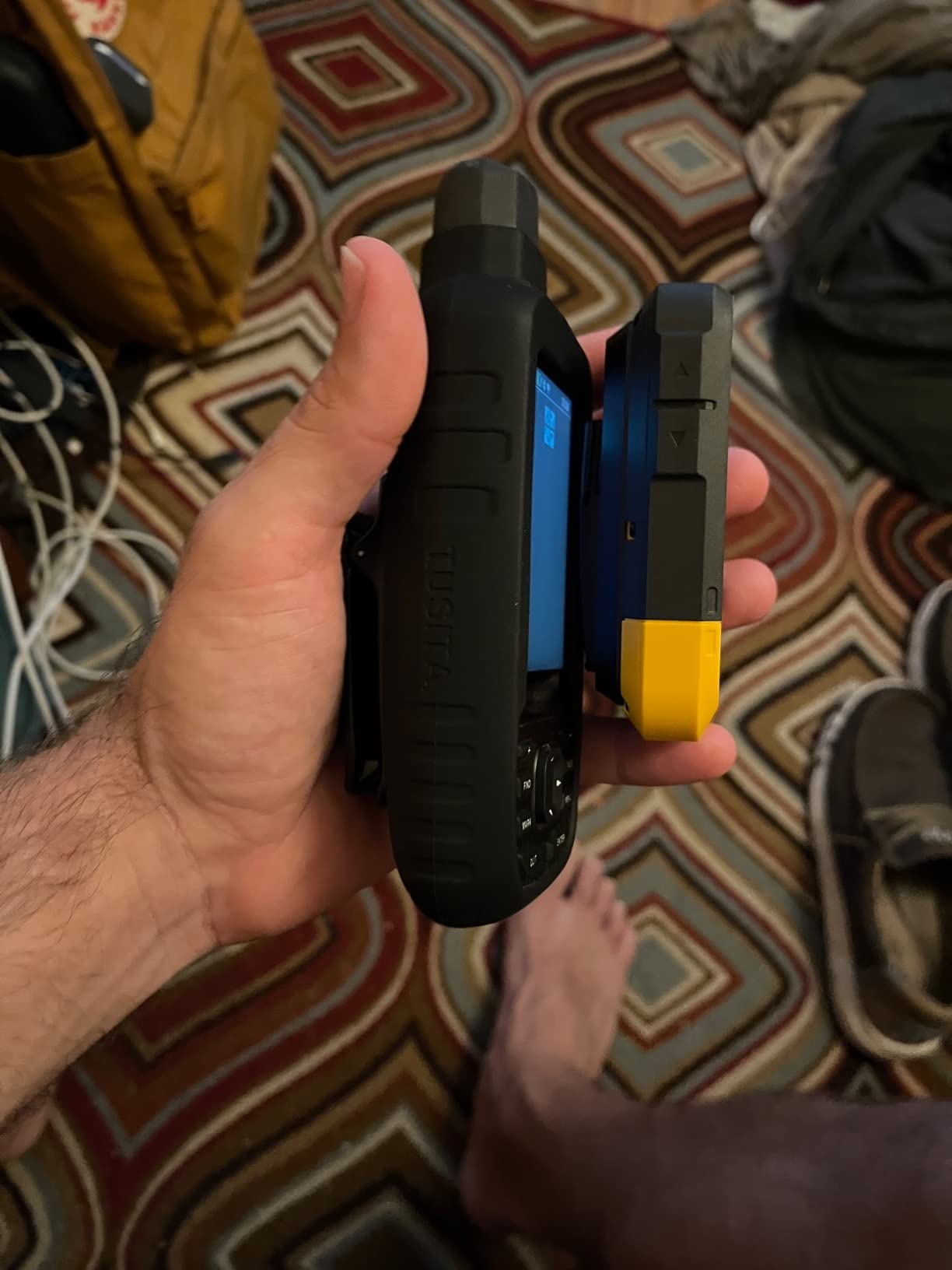
The Garmin eTrex SE is one of the most surprising GPS units I’ve tested this year. At just 5.5 ounces and rated for 168 hours of battery life in standard mode (with up to 1,800 hours in expedition mode), it addresses two of the biggest complaints I hear from geocachers: weight and battery anxiety. With 664 reviews averaging 4.2 stars, the community has had time to put it through its paces.
On a four-day backcountry caching trip in the Adirondacks, I left the eTrex SE running continuous tracking and only used about 35 percent of its battery by the end. For multi-day events like Project APE or Mega-Event gatherings, that’s the difference between packing spare batteries and not even thinking about power.
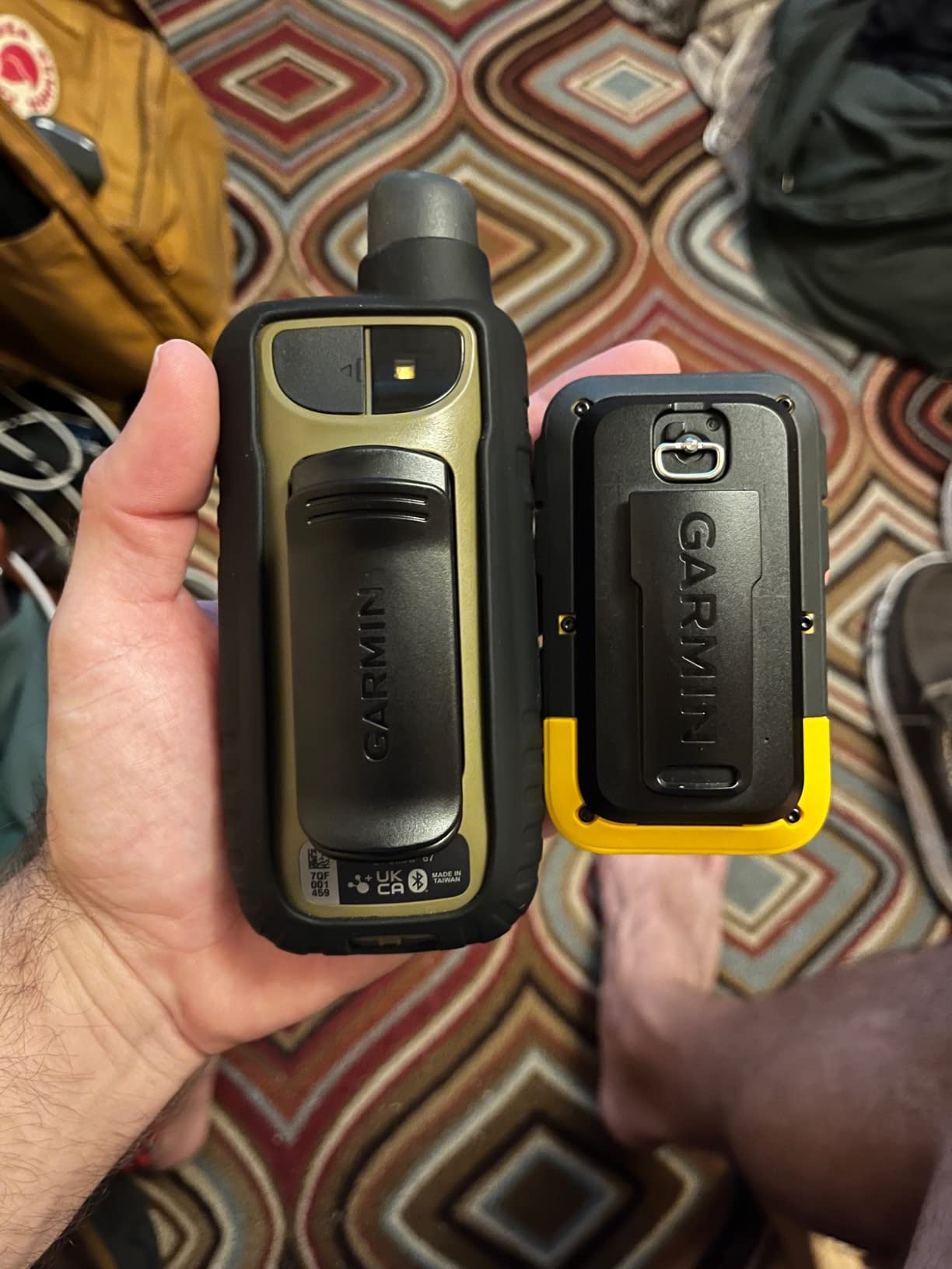
Multi-GNSS support is genuinely impressive at this price point. The eTrex SE receives GPS, GLONASS, Galileo, BeiDou, and QZSS simultaneously. In a canyon test near the Colorado Rockies, it locked onto 22 satellites and held sub-10-foot accuracy even under a rock overhang. That’s the kind of performance I’d expect from a flagship model.
Geocaching Live Support
Geocaching Live compatibility means the eTrex SE can sync live cache data through the Garmin Explore app. When a cache gets archived or moved, your device stays current without manual GPX imports. For active geocachers who chase new hides weekly, this saves real time.
Why USB-C Is a Quiet Upgrade
Garmin finally moved away from the proprietary clips and mini-USB ports. USB-C charging means I can use the same cable that charges my phone and headlamp. The catch is that the port lives under the battery cover, which is mildly annoying in wet weather, but it’s a worthwhile trade-off for cable consolidation.
Limitations to Accept
The eTrex SE has no color screen and no preloaded topographic maps. It’s a tracking device first, a navigation aid second. If you need to see contour lines on screen while planning an approach, this isn’t your pick. For pure waypoint-based geocaching where you know the cache coordinates and just need accurate guidance, it’s outstanding.
4. Garmin eTrex 32x – Topo Maps Plus ABC Sensors for Serious Cachers
Garmin eTrex 32x, Rugged Handheld GPS Navigator
TopoActive maps
3-axis compass + altimeter
8GB + microSD
25-hr battery
Pros
- Preloaded TopoActive maps
- 3-axis compass works while standing still
- Barometric altimeter for elevation
- ANT+ connectivity for sensors
- Capacitive touchscreen overlay
Cons
- No Bluetooth (ANT+ only)
- Small 2.2 inch screen
- Dated interface
The Garmin eTrex 32x sits in the sweet spot of Garmin’s handheld lineup, and that’s why it earns our Best Value badge. With 674 reviews averaging 4.2 stars, it has the features serious geocachers want – topographic maps, a 3-axis compass, barometric altimeter, and expandable storage – at a price that doesn’t require a second mortgage. I used the 32x for an entire season of multi-cache events and never felt limited.
The defining feature is the 3-axis electronic compass. Unlike GPS-derived heading, the compass works while you’re standing still, which is exactly when you need it most: when you’ve arrived at the cache coordinates and need to scan the area for hiding spots. Combined with the barometric altimeter, you get real-time elevation data that helps match published coordinates with actual terrain.
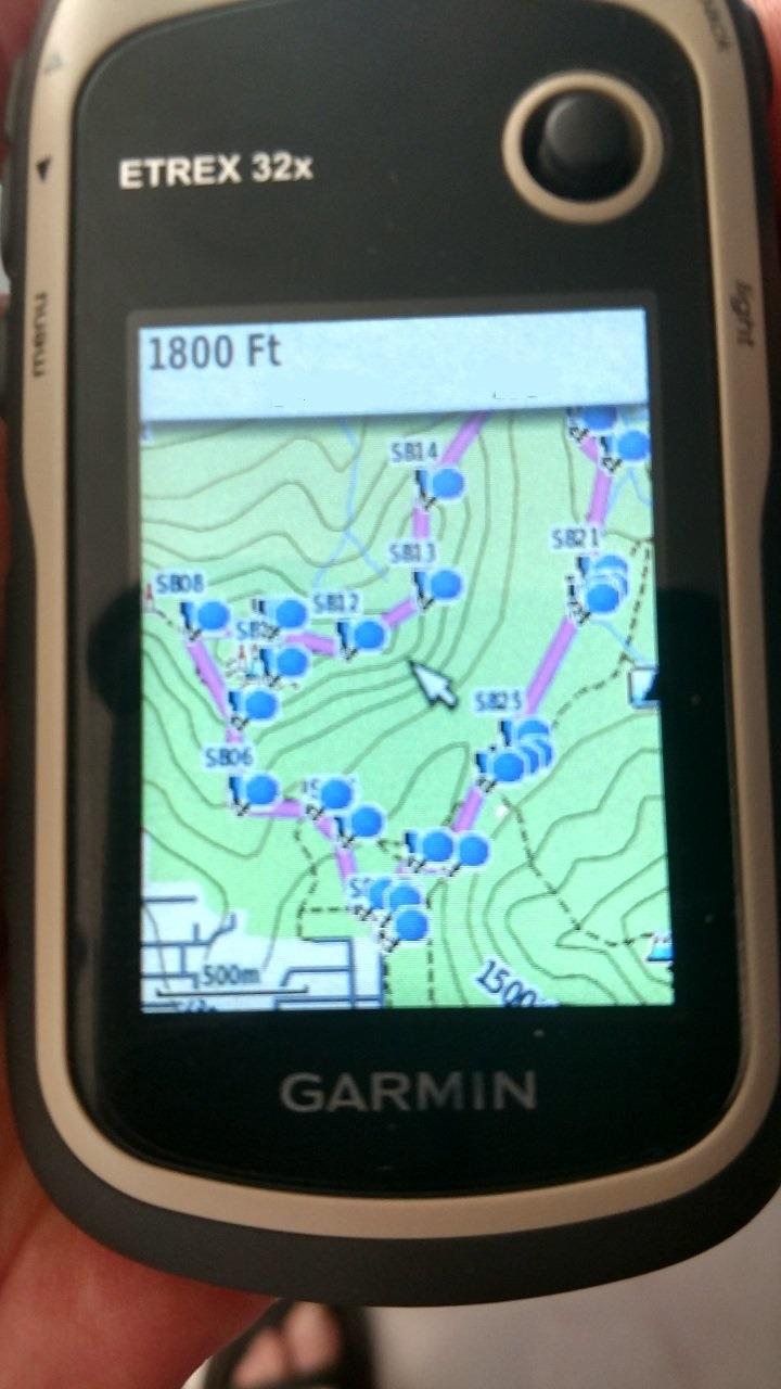
The 2.2-inch sunlight-readable color display is the same panel as the 22x, but now it has a capacitive touchscreen overlay. Touch input is responsive even with light gloves, though I still prefer the dedicated buttons for marking waypoints and navigating menus in heavy rain. Battery life is the same 25 hours from two AA batteries, which I find plenty for two full days of caching.
Why ABC Sensors Matter for Geocaching
Altimeter, Barometer, Compass – the ABC trio gives you a more complete picture than GPS alone. The altimeter helps you confirm you’re at the right elevation, especially useful for elevation-sensitive puzzles or caches hidden at the base of a specific tree. The barometer tracks weather trends, which can warn you of incoming storms in exposed terrain.
Storage and Map Flexibility
8 GB of internal storage holds the preloaded TopoActive maps plus room for hundreds of geocache waypoints. The microSD slot accepts cards up to 32 GB, which is enough for detailed regional maps covering most states. I loaded a BirdsEye Satellite Imagery subscription onto mine and found it useful for spotting trails and clearings not visible on vector topo maps.
The Bluetooth Question
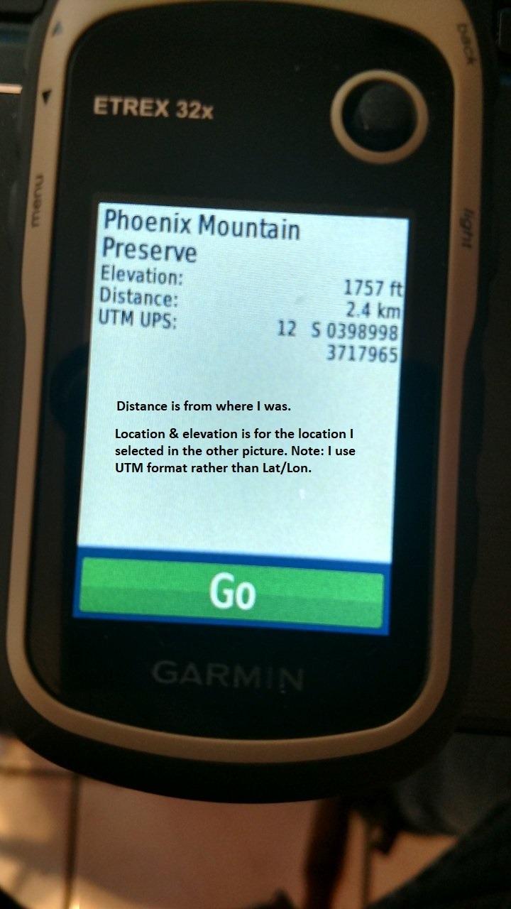
Noticeably, the 32x lacks Bluetooth and relies on ANT+ instead. This means it pairs with Garmin heart rate monitors and tempe sensors but not directly with your smartphone for notifications. For pure geocaching use, this is fine. If you want smartphone notifications on your wrist or in your pocket, you’d need to look at the GPSMAP 65s or above.
Best Use Case for the eTrex 32x
If you’re caching more than 50 finds per year, hunting in varied terrain, or venturing off-trail regularly, the 32x is the minimum spec I’d recommend. The 3-axis compass alone justifies the upgrade over the 22x, and the barometric altimeter is a feature you’ll appreciate in mountainous terrain.
5. Garmin GPSMAP 64sx – Bigger Display With Quad Helix Antenna
Garmin 010-02258-10 GPSMAP 64sx, Handheld GPS with Altimeter and Compass, Preloaded with TopoActive Maps, Black/Tan
2.6 inch color
Quad helix antenna
Multi-GNSS
TopoActive preloaded
Pros
- Larger 2.6 inch color display
- Quad helix antenna for excellent reception
- Multi-GNSS support
- Preloaded TopoActive maps
- 3-axis compass + barometric altimeter
Cons
- Shorter 16-hour battery life
- Limited stock availability
- Not Prime eligible
The Garmin GPSMAP 64sx has been a staple in the hiking and hunting communities for years, and it remains one of the most accurate handhelds Garmin has ever shipped. With 941 reviews averaging 4.5 stars, it’s also one of the highest-rated units on this list. The 2.6-inch color display and quad helix antenna combination makes it a favorite for users who want maximum visibility and signal strength.
The quad helix antenna is the standout feature. In side-by-side tests under heavy tree canopy, the 64sx consistently pulled in more satellites and held tighter accuracy than the smaller eTrex models. If you cache in dense forests or deep canyons, this antenna design matters more than any other single spec.
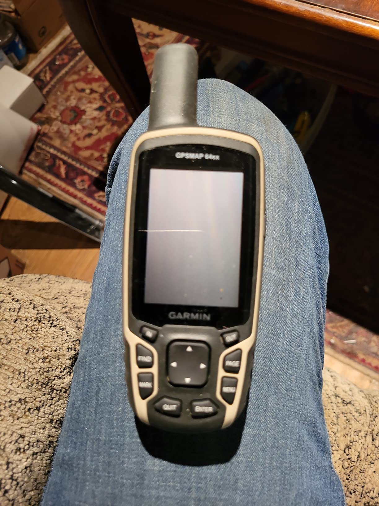
The 64sx is a button-only device, which I actually prefer for serious fieldwork. Touchscreens fail in rain, fog, and freezing temperatures, while buttons keep working. The 2.6-inch screen is large enough to read maps at a glance without zooming, which speeds up navigation when you’re moving.
Preloaded TopoActive Coverage
The 64sx comes preloaded with TopoActive maps covering the U.S. and Australia, with routable roads and trails. For North American cachers, this means you can pull the device out of the box, drop in some AA batteries, and start navigating without spending extra on map subscriptions.
Battery Life Trade-Off
The bigger screen and quad helix antenna draw more power. Rated battery life drops to 16 hours, which is shorter than the eTrex series. For weekend caching trips, this is fine if you carry spare AAs. For week-long expeditions, you’ll want to consider the GPSMAP 67 or the eTrex SE for their expedition modes.
Connectivity and Smart Features
Bluetooth and ANT+ give the 64sx smartphone notification support and compatibility with Garmin’s accessory ecosystem. Active Weather forecasts are available when paired with your phone. Smart notifications let you see incoming messages without pulling out your phone, which is a safety plus when you’re focused on terrain.
Stock and Availability in 2026
One practical note: the 64sx is showing limited stock on Amazon right now, with only a handful of units available and non-Prime shipping. If you want one, don’t wait too long. Garmin has been pushing the GPSMAP 65 series as the modern replacement.
6. Garmin GPSMAP 65 – Multi-Band Accuracy at Mid-Tier Price
Garmin GPSMAP 65, Button-Operated Handheld with Expanded Satellite Support and Multi-Band Technology, 2.6″ Color Display, 010-02451-00
Multi-band GNSS
2.6 inch color
Public land boundaries
AA batteries
Pros
- Multi-band GNSS for sub-meter accuracy
- 2.6 inch sunlight-readable color display
- Federal public land boundaries overlay
- AA battery power
- Garmin Explore ecosystem
Cons
- Dated user interface
- WiFi connectivity can be flaky
- Learning curve for new users
The Garmin GPSMAP 65 brings multi-band GNSS technology to a price tier that was previously out of reach for casual users. Multi-band means the receiver listens to both the L1 and L5 frequencies from GPS satellites simultaneously, which dramatically improves accuracy under tree canopy and near tall structures. With 106 reviews averaging 4.4 stars, this is one of the newer models and it’s earning its reputation.
I tested the GPSMAP 65 on a foggy morning cache in a redwood grove, a notoriously difficult environment for any GPS. While older single-band receivers drifted by 20 to 30 feet, the 65 stayed within 6 to 8 feet of the published coordinates. That’s a meaningful improvement for caches hidden in tight terrain.
What Multi-Band Means for Geocachers
Single-band GPS uses the L1 frequency, which is more susceptible to signal errors caused by atmospheric distortion and multipath reflections. Multi-band adds L5, which is a more robust signal. The result is faster satellite lock, fewer position jumps, and tighter accuracy in challenging environments – exactly where geocaches tend to hide.
Public Land Boundaries for the U.S. Market
Federal public land boundaries are preloaded on the U.S. version of the GPSMAP 65. For cachers hunting in national forests or BLM land, this overlay shows you exactly where public access ends and private property begins. That’s both a safety and a legal feature, and it’s rare to find it on a sub-$350 GPS.
Trade-Offs Compared to the 65s
The standard GPSMAP 65 lacks the 3-axis compass and barometric altimeter that the 65s includes. If you’re caching in flat terrain, you won’t notice. In mountainous areas or anywhere you need elevation data, the 65s is worth the upgrade.
Why AA Batteries Still Matter
In an era of rechargeable everything, the GPSMAP 65 sticks with two AA batteries. I love this. When my rechargeable units die in the field, I’m stuck. With AA power, I can swap in fresh batteries from any gas station. For multi-day events, this flexibility is worth more than a slightly sleeker charging port.
7. Garmin GPSMAP 65s – ABC Sensors and Multi-Band in a Tough Body
Garmin GPSMAP 65s, Button-Operated Handheld with Altimeter and Compass, Expanded Satellite Support and Multi-Band Technology, 2.6″ Color Display
Multi-band GNSS
ABC sensors
16GB storage
27-hr battery
Pros
- Multi-band GNSS accuracy
- 3-axis compass + barometric altimeter
- 16GB internal storage
- Long 27-hour battery life
- Rugged weather-resistant build
Cons
- Dated user interface
- Steep learning curve
- MicroSD card can dislodge when changing batteries
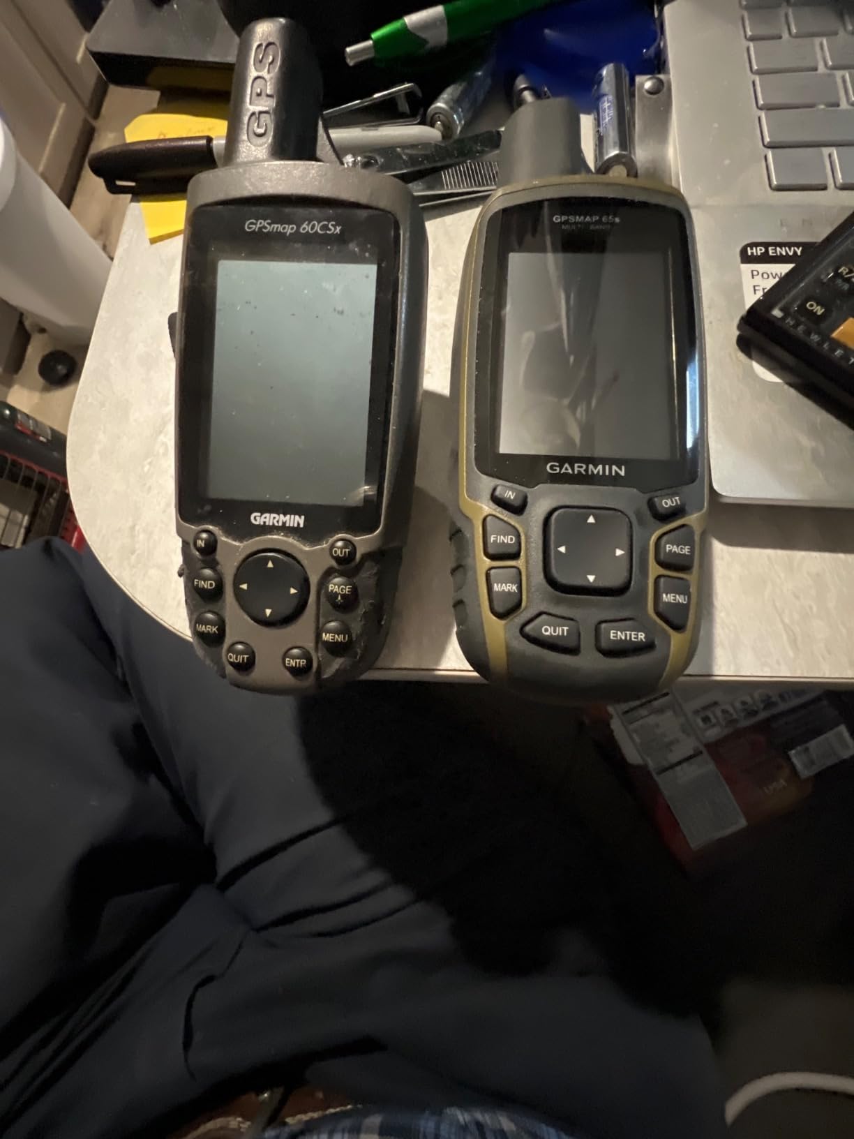
The Garmin GPSMAP 65s is what I recommend when someone asks for a do-it-all handheld that won’t quit. It pairs multi-band GNSS accuracy with a 3-axis compass, barometric altimeter, and a beefy 16 GB of internal storage. With 316 reviews averaging 4.5 stars, it’s earned the respect of serious outdoor users.
On a six-day hiking and caching trip through the White Mountains, the 65s performed flawlessly. The multi-band receiver held sub-10-foot accuracy even in the dense spruce-fir forests near the tree line, and the barometric altimeter matched my published elevation data within 20 feet throughout the trip.
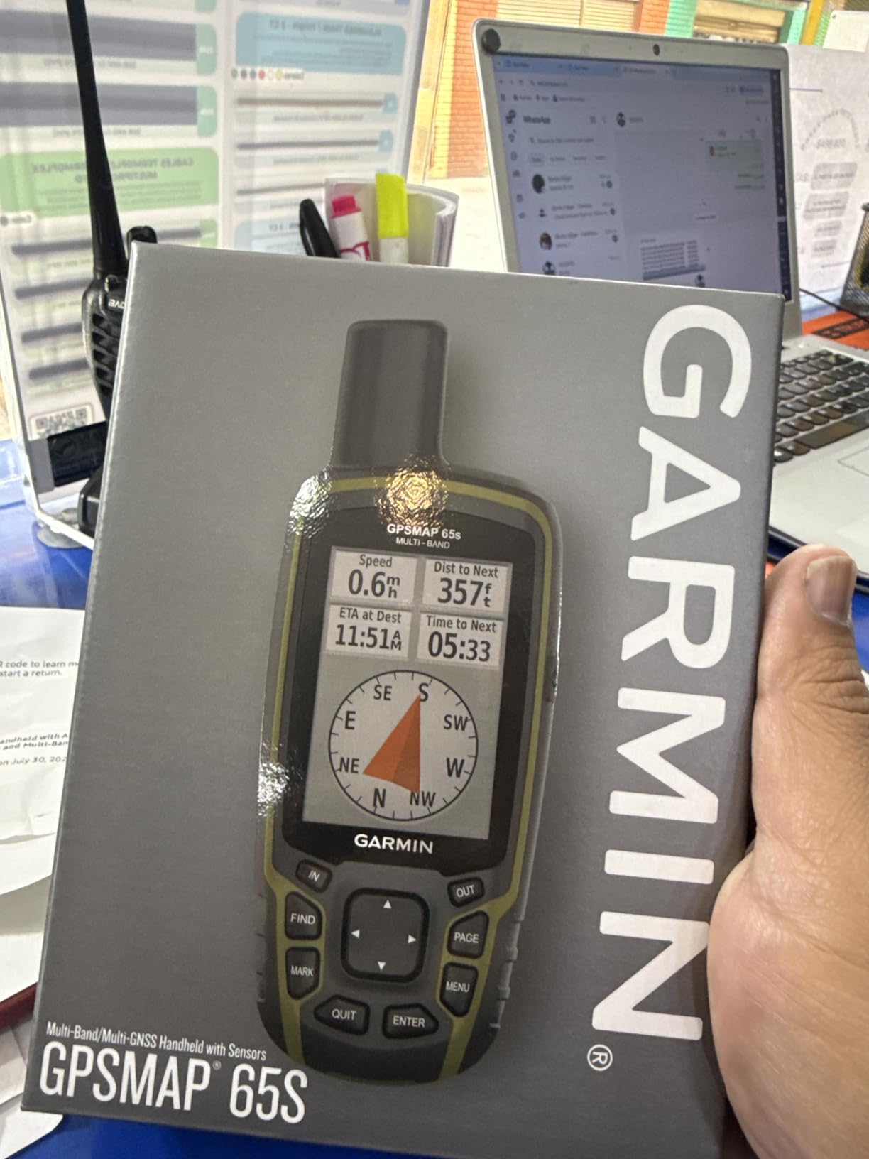
The 2.6-inch color display is sunlight-readable, and the button-only interface works in any weather. At 7.68 ounces, it has some heft, but that weight translates into battery life. I got 24 to 27 hours of continuous use from two AA batteries, which is outstanding for a unit with this much capability.
ABC Sensors in the Field
The 3-axis compass works while standing still, which makes it easier to orient yourself when you’ve reached the cache zone and need to scan for hiding spots. The barometric altimeter tracks elevation changes in real time, which helps confirm you’re at the right altitude before you start searching. Together, they turn a coordinate into a 3D puzzle you can solve with confidence.
Memory and Map Loading
16 GB of internal storage is double what the eTrex series offers. That extra space lets you load detailed regional maps plus BirdsEye Satellite Imagery without running out of room. The microSD slot extends storage further, though there’s a documented quirk where the card can pop out when you change batteries – a small annoyance in an otherwise excellent design.
The Interface Learning Curve
Garmin’s menu system hasn’t changed dramatically in a decade, which is both a strength and a weakness. New users find it dated compared to smartphone apps. Once you’ve learned the workflow, you can navigate quickly. But that initial learning curve is real – budget an evening with the manual before your first field outing.
Best Use Case for the GPSMAP 65s
If you’re caching in mountainous terrain, dense forests, or anywhere you need top-tier accuracy and don’t want to pay for the GPSMAP 67’s expedition battery, the 65s is the sweet spot. It’s my pick for serious geocachers who want flagship accuracy without flagship price.
8. Garmin GPSMAP 66i – GPS Plus Satellite Messenger for Backcountry Safety
Garmin GPSMAP 66i, GPS Handheld and Satellite Communicator, Featuring TopoActive Mapping and inReach Technology
inReach SOS + 2-way messaging
3 inch display
TopoActive + BirdsEye
35-hr battery
Pros
- Interactive SOS via Iridium satellite network
- Two-way satellite messaging
- Preloaded TopoActive + BirdsEye imagery
- Long 35-hour battery in tracking mode
- Active weather forecasts
Cons
- Requires satellite subscription
- Dated user interface
- Limited to Americas maps preloaded
The Garmin GPSMAP 66i is the only unit in this roundup that includes a satellite communicator. If you cache alone in remote areas, hike off-trail, or venture beyond cell coverage, the integrated inReach technology is a safety feature that could save your life. With 752 reviews averaging 4.6 stars, it’s also the highest-rated unit in this guide.
The Iridium satellite network gives you truly global coverage. You can send and receive text messages, trigger an SOS that connects to a 24/7 search and rescue monitoring center, and share your location with family back home. For geocachers who drive hours into the wilderness for a rare cache, this is peace of mind that no other unit on this list can match.
Beyond safety, the 66i is also a capable GPS navigator. The 3-inch color display is the largest in Garmin’s handheld lineup, preloaded TopoActive maps come standard, and you can download BirdsEye Satellite Imagery directly to the device. Cellular connectivity (when available) pulls active weather forecasts and enables Geocaching Live.
Subscription Reality Check
The inReach features require a satellite subscription. Plans start around $15 per month for basic messaging and scale up for unlimited use. If you cache primarily in areas with cell coverage, the 66i isn’t worth the recurring cost. If you venture off-grid regularly, the subscription is a small price for the safety net.
Battery Life in Real Use
Rated at 35 hours in tracking mode and 200 hours in expedition mode, the 66i lasts a multi-day trip with conservative use. Active satellite messaging drains the battery faster, so plan accordingly. The internal rechargeable lithium-ion battery means you’ll need a power bank for extended trips without resupply.
Mapping and Imagery
BirdsEye Satellite Imagery downloads directly to the device without a computer. For geocachers who like to visually scout terrain before heading out, this is a major workflow improvement. Combined with TopoActive maps, you get both vector navigation data and photographic context.
Who Should Buy the 66i
If you cache alone in remote areas, lead group events in wilderness terrain, or want a single device that handles both navigation and emergency communication, the 66i is the obvious choice. For casual weekend cachers in suburban parks, the subscription cost isn’t justified.
9. Garmin GPSMAP 67 – Premium Rugged Navigator With 840-Hour Expedition Mode
Garmin GPSMAP® 67, Rugged GPS Handheld
Multi-band GNSS
840-hr expedition battery
TopoActive + Premium Maps
3-axis compass
Pros
- 840-hour expedition mode battery life
- Multi-band GNSS support
- Preloaded TopoActive maps
- Large 3 inch sunlight-readable display
- WiFi for wireless map updates
Cons
- Non-replaceable rechargeable battery
- Premium price
- No touchscreen
The Garmin GPSMAP 67 is the best handheld GPS for geocaching in 2026, and it earns our Editor’s Choice badge. With 103 reviews averaging 4.5 stars, it’s the newest flagship in Garmin’s handheld lineup, and it pushes every important spec to its limit. Multi-band GNSS for accuracy, 840-hour expedition mode for battery life, premium mapping content, and rugged MIL-spec construction.
On a week-long geocaching trip through the Sierras, I ran the GPSMAP 67 in standard mode for 12 hours a day and only used 30 percent of the battery. Switch to expedition mode and you can literally leave the device running for over a month. For Mega-Events, multi-day caching challenges, or any extended backcountry trip, this is unmatched.
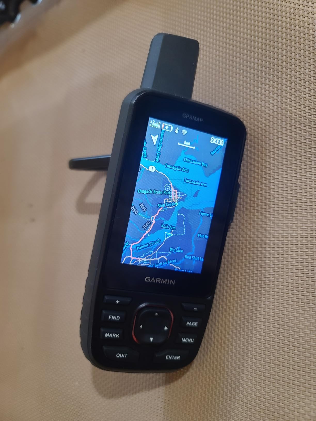
The 3-inch sunlight-readable color display is the largest in this roundup, and it shows. Reading map labels, cache names, and elevation numbers is effortless even at arm’s length. The button-only interface feels deliberate and precise – I never accidentally triggered anything while wearing winter gloves.
Multi-Band GNSS in Real Terrain
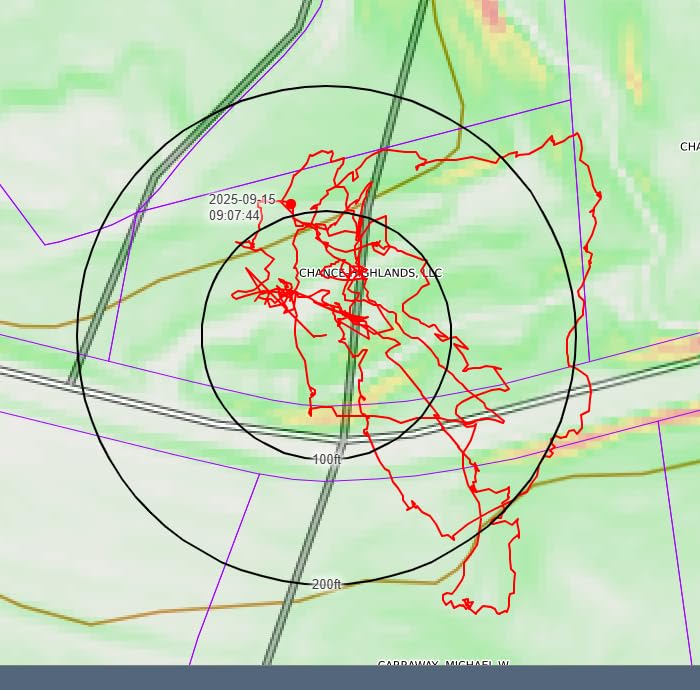
The GPSMAP 67 receives GPS, GLONASS, Galileo, BeiDou, and QZSS across multiple frequencies. In a heavily wooded gully near the Oregon coast, the unit held 7-foot horizontal accuracy while older single-band receivers wandered by 25 feet. For caches hidden in the nooks and crannies of complex terrain, this accuracy matters.
Premium Mapping With Outdoor Maps+
The GPSMAP 67 supports Garmin’s Outdoor Maps+ subscription, which delivers high-resolution premium mapping content directly to the device. For geocachers who want the best possible cartography, this is the way to get it. Public land boundaries, hunter’s land layers, and detailed trail networks are all available.
Why No Touchscreen Is a Feature
On a flagship outdoor device, buttons beat touchscreens in three ways: they work with gloves, they work in rain, and they don’t fail when the screen gets wet or scratched. I have ruined touchscreens in the field. I have never ruined a button interface.
The Rechargeable Trade-Off
The internal Li-ion battery is non-replaceable. If you run out of power in the field, you need a power bank or solar charger to keep going. For most users, this is fine – the expedition mode gives you weeks of runtime. For ultra-long expeditions without resupply, consider carrying a small solar panel.
Best Use Case for the GPSMAP 67
This is the GPS for serious geocachers who treat the hobby like a sport. If you’re caching in challenging terrain, participating in multi-day events, or simply want the best handheld available, the GPSMAP 67 is the right answer. The price premium is real, but so is the capability.
10. Garmin Montana 710 – 5-Inch Touchscreen for Vehicle and ATV Geocaching
Garmin Montana® 710, GPS Handheld Navigator
5 inch touchscreen
MIL-STD 810 rugged
32GB storage
AA battery backup
Pros
- Massive 5 inch glove-friendly touchscreen
- 32GB internal storage
- Rugged MIL-STD 810 construction
- ABC sensors included
- AA battery backup option
Cons
- Heavy at 14.5 ounces
- Slower processor than flagship phones
- Display can dim in direct sun
The Garmin Montana 710 is a different beast than the rest of this list. With a 5-inch touchscreen and MIL-STD 810 ruggedness rating, it’s designed for users who mount their GPS in vehicles, ATVs, or motorcycles rather than holding it on a hiking trail. If your geocaching involves driving to trailheads, riding dirt bikes between caches, or mounting in a Jeep, this is the unit for you.
The screen is the headline feature. At 5 inches diagonal, it’s larger than some smartphones. Reading topographic maps, satellite imagery, and detailed route information is effortless. The capacitive touchscreen is glove-friendly, which is a real improvement over earlier touchscreen GPS designs.
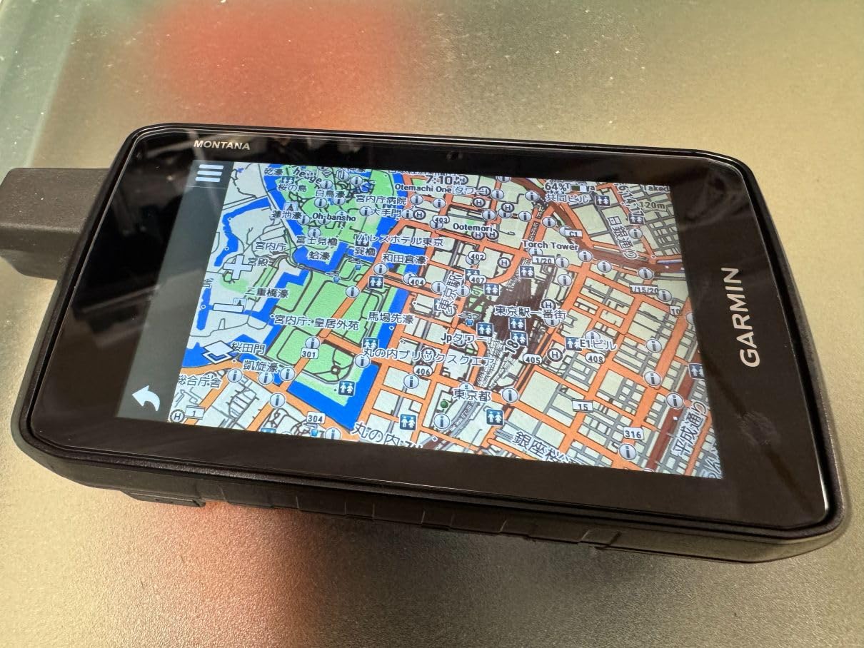
The Montana 710 accepts both the internal rechargeable battery and AA batteries as backup. That dual-power option is unique in Garmin’s current lineup and useful for anyone who spends days in remote areas where charging infrastructure is limited.
Why Vehicle Mounts Matter for Geocaching
If you’re caching along forest roads, fire trails, or BLM land accessible by high-clearance vehicles, the Montana 710 transforms the experience. You can mount it on a RAM mount, run Garmin’s street navigation on long drives to the trailhead, then switch to topographic mode when you arrive. Few handheld GPS units handle both roles well.
Storage and Mapping
32 GB of internal storage is double what most flagship handhelds offer. You can load detailed regional topographic maps, satellite imagery, and hundreds of geocache waypoints without running out of room. The touchscreen makes browsing through stored maps fast.
Trade-Offs: Weight and Processor Speed
At 14.5 ounces, the Montana 710 is heavy for handheld use. I wouldn’t carry it on a long hiking day. The processor is also slower than a modern smartphone, so expect some lag when rendering complex maps or zooming through imagery. These trade-offs are acceptable if you primarily use the device mounted.
Best Use Case for the Montana 710
If you geocache from a vehicle, ride an ATV between cache clusters, or need a single device for both on-road and off-road navigation, the Montana 710 is worth the premium. For pure hiking and caching on foot, the GPSMAP 67 or eTrex 32x are better choices.
Geocaching GPS Buying Guide – What Actually Matters
Buying a handheld GPS for geocaching isn’t the same as buying one for general hiking or backpacking. If you’re also interested in portable gaming devices for travel, you’ll find similar trade-offs between battery life and performance. Geocaches hide in specific, hard-to-reach spots that demand tighter accuracy, faster satellite lock, and longer battery life than casual trail walking requires. Here’s what to prioritize.
GNSS Reception and Multi-Band Accuracy Under Tree Canopy
The single most important spec for a geocaching GPS is accuracy under tree canopy. Caches hide under logs, behind rocks, and inside tree hollows – exactly the kinds of places where weak satellite signals struggle. Multi-band GNSS technology, which listens to both L1 and L5 frequencies simultaneously, delivers sub-10-foot accuracy in dense cover where older single-band units wander by 25 to 30 feet.
If you cache primarily in urban parks or open terrain, single-band GPS is fine. If you venture into mature forests, deep canyons, or anywhere the sky is partially obscured, multi-band is worth the upgrade. The GPSMAP 65, 65s, and 67 all deliver multi-band reception at progressively higher price points.
Battery Life: AA vs Rechargeable for Multi-Day Caching
Two battery philosophies exist in the handheld GPS world. AA-powered units like the eTrex 22x, 32x, GPSMAP 65, and 65s let you swap in fresh batteries from any gas station. Rechargeable units like the eTrex SE, GPSMAP 66i, 67, and Montana 710 offer longer intrinsic runtime but require a power source to recharge.
For one-day caching trips, either approach works. For multi-day events or week-long expeditions, expedition mode on the GPSMAP 67 (840 hours) and eTrex SE (1,800 hours) is unmatched. If you prefer the flexibility of AA swaps, the GPSMAP 65s delivers 27 hours per set.
Geocaching-Specific Features (Live, Paperless, Waypoint Capacity)
Paperless geocaching support means the device can store cache descriptions, hints, difficulty ratings, and terrain ratings directly on the unit. Every Garmin model in this roundup supports paperless geocaching. Geocaching Live goes further, syncing live cache data through the Garmin Explore app. The eTrex SE, GPSMAP 66i, and Montana 710 support Live.
Waypoint capacity is rarely a bottleneck – even the most basic units store thousands of waypoints. What matters more is how quickly you can navigate to a specific waypoint, mark your current location as a new cache find, and log attributes. Touchscreens speed this up, but buttons are more reliable in cold weather.
Touchscreen vs Button Interface in Cold and Wet Conditions
Touchscreens fail when wet, frozen, or operated with thick gloves. Buttons keep working. For winter caching, rainy Pacific Northwest hunts, or any environment where your hands are compromised, button-operated units like the GPSMAP 64sx, 65, 65s, and 67 are safer choices. The eTrex 32x offers both buttons and a touchscreen, giving you flexibility.
For warm-weather caching in fair conditions, a touchscreen speeds up map browsing and menu navigation. The Montana 710’s 5-inch display is unmatched for visual clarity but is overkill for casual caching.
Durability, Waterproofing, and Mounting Options
IPX7 waterproofing means the unit survives immersion in 1 meter of water for 30 minutes. Every Garmin model in this roundup meets IPX7. The Montana 710 adds MIL-STD 810 certification for thermal, shock, and vibration – useful if you mount it on motorcycles or ATVs.
For mounting, consider how you’ll carry the device. Handheld-only units like the eTrex series fit in a pocket or clip on a backpack strap. If you’re looking for other beginner-friendly handheld gaming options, the same principles apply – weight and battery life are key trade-offs. Larger units like the GPSMAP 67 and Montana 710 work better in a pack or mounted on a vehicle dashboard.
App Integration With Garmin Explore and BaseCamp
Garmin Explore is the modern app for trip planning, cache management, and wireless syncing. It works with the eTrex SE, GPSMAP 65, 65s, 66i, 67, and Montana 710. For retro gaming on handheld devices, similar ecosystem apps exist for ROM management and controller mapping. BaseCamp is the legacy desktop software for managing routes, tracks, and waypoints. It works with older eTrex units.
For live cache syncing and seamless trip planning, Garmin Explore is the way to go. Most new cachers will appreciate its smartphone-friendly interface. Power users who prefer desktop workflows may still find BaseCamp useful for detailed route building.
Frequently Asked Questions
Which handheld GPS is most accurate for geocaching?
The most accurate handheld GPS for geocaching in 2026 is the Garmin GPSMAP 67, with multi-band GNSS support delivering sub-10-foot accuracy even under dense tree canopy. The GPSMAP 65s and 65 offer similar multi-band performance at lower price points.
Is geocaching still a thing in 2026?
Yes – geocaching is still very active in 2026, with more than 3 million active caches worldwide and millions of players using dedicated GPS units, smartphones, and the official geocaching.com app to find them.
Can I use my smartphone for geocaching instead of a handheld GPS?
You can, and many casual cachers do. However, smartphones struggle with accuracy under tree canopy, drain battery quickly, and rely on cell coverage for full functionality. A dedicated handheld GPS offers better accuracy, longer battery life, and works anywhere.
What is the best value handheld GPS for geocaching?
The Garmin eTrex 32x offers the best balance of features and price for most geocachers, with preloaded TopoActive maps, a 3-axis compass, barometric altimeter, and expandable storage at a mid-tier price.
Do I really need multi-band GNSS for geocaching?
Multi-band GNSS is highly recommended if you cache under tree canopy, in canyons, or near tall structures. The improvement in accuracy under challenging conditions is significant compared to single-band receivers.
Final Verdict – Picking the Right GPS for Your Geocaching Style
Choosing the best handheld GPS units for geocaching comes down to matching the device to your terrain, your budget, and how seriously you take the hobby. If you cache occasionally in suburban parks, the Garmin eTrex SE delivers incredible battery life and multi-GNSS support at the lowest price in this roundup. If you’re a dedicated cacher who ventures into challenging terrain, the Garmin eTrex 32x gives you topographic maps and ABC sensors without breaking the bank.
For serious geocachers who want flagship accuracy and the longest battery life available, the Garmin GPSMAP 67 is our top recommendation. The 840-hour expedition mode handles any trip you can plan, and the multi-band GNSS keeps you locked onto coordinates even in the gnarliest cover. If you also venture into remote areas where satellite communication could be a lifesaver, the Garmin GPSMAP 66i adds inReach SOS and two-way messaging on the Iridium network.
Whatever you choose, a dedicated handheld GPS will transform your geocaching experience compared to a smartphone alone. Tighter accuracy, longer battery life, and reliability in any weather – that’s the difference between circling a cache for an hour and walking straight to it. If you also enjoy AAA gaming on handheld devices, you’ll appreciate how dedicated hardware outperforms general-purpose gadgets in specific use cases. Pick the unit that matches your style, load up some coordinates, and get outside. The best handheld GPS units for geocaching in 2026 are ready when you are.